The CFGP is continuing work on implementing the recommendations from the 2020 Community Wildfire Protection Plan specific to areas within the Community Forest Landbase. See the map below for details:
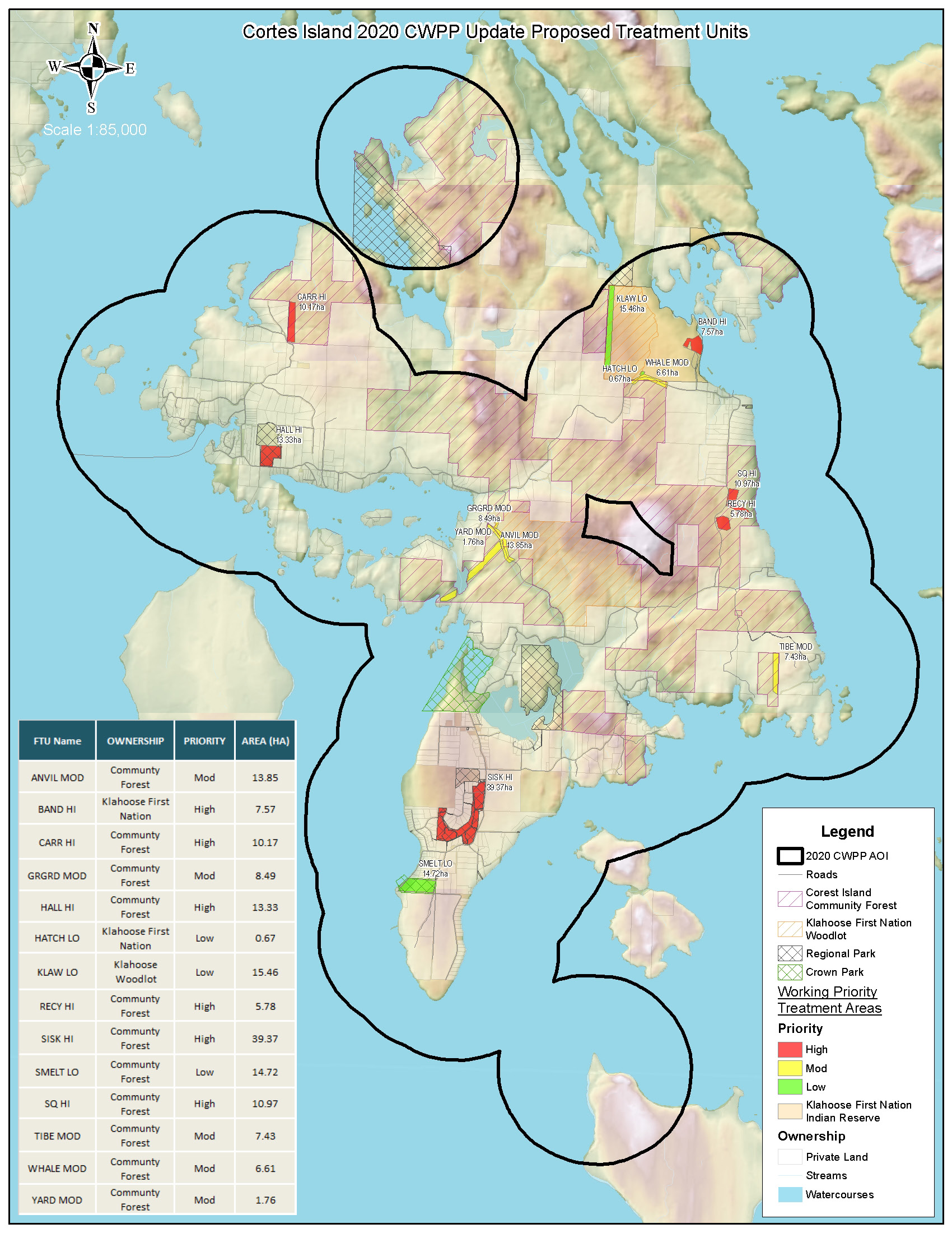
Those recommendations include building road access to specific areas crossing the community forest, along with thinning along the western boundary in the Carringto/Coulter Bay Area and in the overgrown 3rd growth blocks in the Squirrel Cove Area of the Community Forest. The prescriptions for these are available here:
CarrHi_Boundary
CARRINGTON FMP Prescription 2021_DRAFT__AUG25_2021
SQ_HI
SQUIRREL COVE FMP Prescription 2021_DRAFT__AUG25_2021
A thinning project in the area surrounding the area surrounding the recylcing center was completed in March 2022. The map of the area is available here:
RecyHi_Boundary
RECYCLING FMP Prescription 2021_DRAFT
The plan also calls for a fire break in the Gorge Harbour/Anvil Lake area, which was partially completed in 2022 & 2023 by building initial road access in the area, and harvesting the small fire break called block GH1.
Futher road building in the area is planned for early 2024 in order to gain access, and eventually plant Alder at the western end of the wetland to the south of block GH1 in an area infected with mistletoe Hemlock. That project would take place sometime in the future and the area is shown on the maps below as block GH2.
The first map shows the next length of road to be built in early 2024, and the second map shows block GH1 which was harvested in 2023 and block GH2 which is under consideration to be planted in Alder at some as of yet undetermined time in the future.
GH Mainline Road Construction Map 20220907
Some of the wildfire risk reduction treatment work in the Carrington Bay/Carrington and Squirrel Cove Areas may be completed concurrently with harvesting in those areas as per the five year plan, depending on funding availability,